Hiking in the Towada-Hachimantai National Park

Leave mundane life behind and enter another world in the Towada-Hachimantai National Park! Hike past hidden waterfalls and through mysterious volcanic landscapes! Experience a Japan unlike what you’ve known before! (As with all hikes, wear appropriate clothing and don’t forget to bring plenty of water.)

Hachimantai Nature Observation Trail

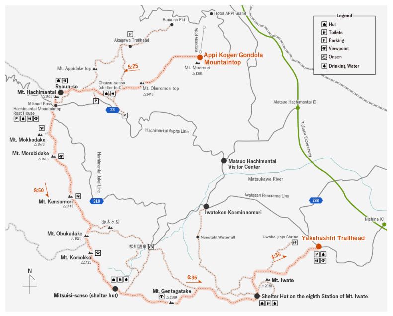
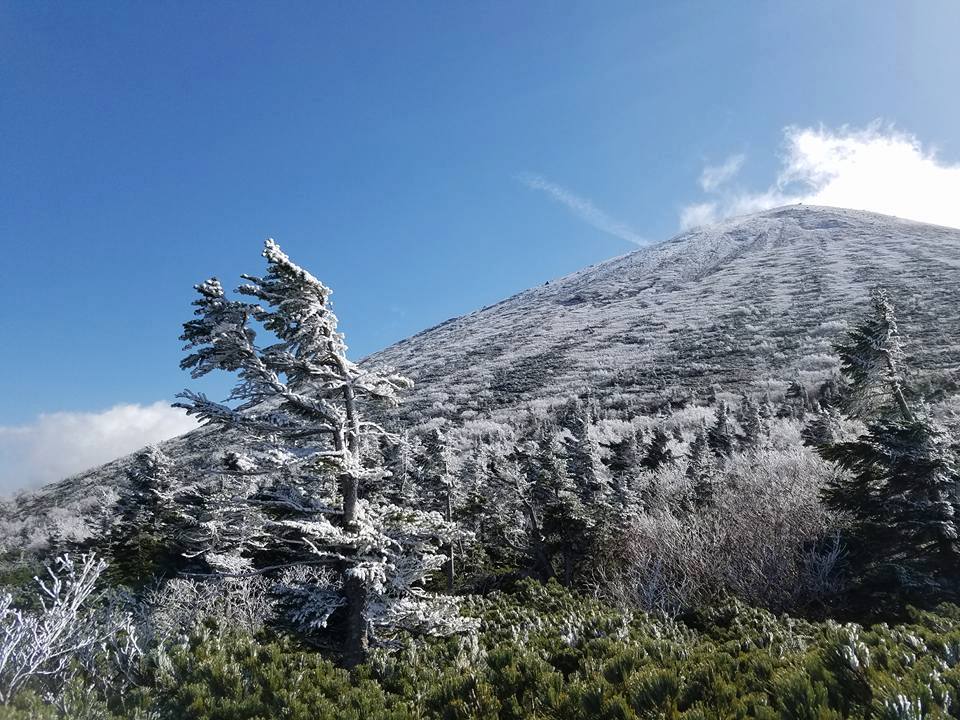
(Level: Beginner Length: 1 to 3 hours depending on the route)

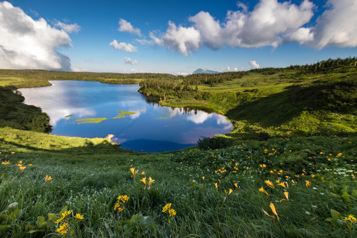
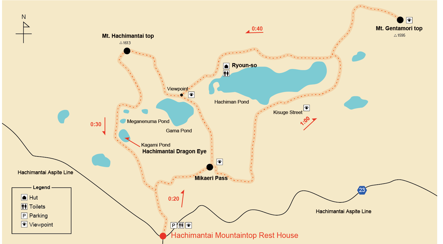
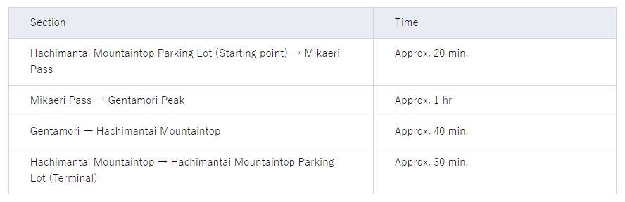
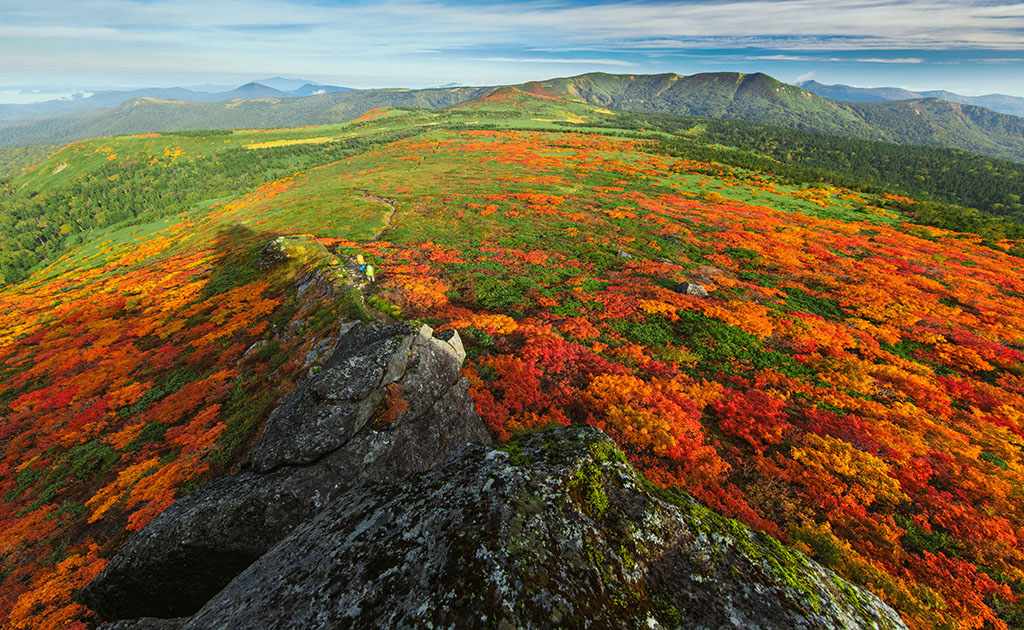
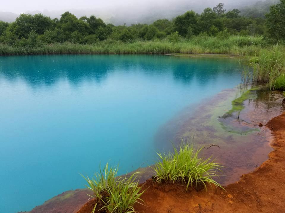
Near the summit of Hachimantai at the top of the Aspite Line where it meets the Jukai Line, there is a popular set of trails that loop around Hachiman-numa and Kagami-numa ponds through a beautiful alpine marshland. The trails are very well-maintained, and there are wooden boardwalks through areas of wetland. Maps and information about local fauna and flora are posted along the trail. There is even a lodge with a bathroom along the way. You can adjust the length of your hike by taking one of the longer or shorter loops through this stunningly beautiful area. Only accessible while the Hachimantai Aspite Line is open from mid-March through November. (Be advised, in the early spring you may need snowshoes.) The flowers that bloom along the trail in June make that season particularly popular among locals.

Before you go up the Aspite Line, stop at the Hachimantai Visitor Center. You can check a live video feed there of conditions at the summit.  There’s also a facility called “Sanchoku Aspite” right next to it, where you can buy delicious locally made lunches to go, and enjoy eating them while seated at the wooden deck overlooking the ponds at the summit area.

The Hachimantai Aspite Line opens April 15th, and the Jukai Line opens April 26th.

Hachiman-numa

Mt. Mitsuishi

(Level: Intermediate Length: Around 3 to 4 hours for most)

Mt. Mitsuishi is one of the most popular hikes in this area, and with good reason. The short alpine trees near the summit turn bright orange and red as early as September each year, making this one of the first places to enjoy the autumn colors. The trail is well-marked and appropriate for children and elderly as well, provided they don’t mind the long ascent to the summit at an altitude of 1,466 meters. This is a great option for fit people without much hiking experience.

Mount Mitsuishi
SectionTime
Matsukawaso - Mitsuishi Sanso2 hrs
Mitsuishi Sanso - Mountaintop30 min.

Mt. Iwate - Yakehashiri Course

(Level: Intermediate Length: 6 to 9 hours depending your pace)

Mt. Iwate is the highest mountain in Iwate and has been selected as one of Japan’s 100 most beautiful mountains. The smooth slope of the east side resembles the shape of Mt. Fuji, while the other side forms part of a mountain range stretching into Akita prefecture. There are numerous trails to the summit, each with their own charms.  The Yakehashiri Course starts next to an area transformed by an ancient volcanic eruption and is covered in volcanic rock. The trail leads through the forest passing a lodge and eventually to the barren volcanic summit. The best season is said to be late June because of the flowers blooming along the trail.

Mt. Iwate – Nanataki Course

(Level: Advanced Length: Very long… 6 to 9 hours)

The Nanataki course is the longest of the normal trails to the summit of Mt. Iwate. The name means 7 waterfalls, as during the first part of the trail, you indeed pass numerous beautiful waterfalls. After climbing out of the forest, you pass through a rather thrilling volcanic area with sulfuric gas steaming out of crevasses, after which you enter an alpine forest before finally emerging into the barren volcanic area around the summit. This is a somewhat challenging though extraordinarily rewarding hike recommended for experienced hikers (and the favorite of this hiker). Be sure to bring a map or at least check maps in advance, as there are a couple of forks along the way.

Mt. Iwate – Uwabo Course

(Level: Intermediate Length: about 4 to 6 hours depending on your pace)

The most difficult part of the Uwabo course up Mt. Iwate is finding the trailhead. While only a short drive from the Yakehashiri trailhead, there is only a small sign labeling the turn, and there’s a dirt road through a logging area that must be navigated prior to finding the small hut and parking lot that marks the starting point. The hike starts in the forest and eventually climbs up and joins the Yakehashiri trail. It is basically a shortcut that cuts a few hours off the Yakehashiri course for people with less time or who prefer a quicker ascent. (Be advised that there is no bathroom at the trailhead, so best to stop at the Yakehashiri rest area first.)

Gozaisho-numa/Goshiki-numa Ponds Trail

(Level: Beginner Length: 30 minutes to 1 hour)

A short trail from the parking area leads to Goshiki-numa pond, which literally means 5-color pond. The volcanic minerals that feed into the lake cause the color of the pond to change throughout the seasons. In the heat of the summer the waters are a stunningly deep blue, which is accented by the red clay banks. Gozaisho-numa Pond is directly adjacent, and quite beautiful, though it lacks the unique coloring of its neighbor. There is a small gazebo that provides a view of both ponds, allowing visitors to appreciate their differences.